Provides highly flexible environment for visualization & manipulation of geodata
6.1.1
Geocap 4.1
No specific info about version 4.1. Please visit the main page of Geocap on Software Informer.
Environment for rapid engineering and scientific processing.
Program for the interactive visualisation of plate-tectonics.
Tool for easy access and visualization of earth science data.
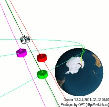
Software for visualization of satellite orbits
Build the software that defines the human machine interface.
Computer-based system capable of simulating, predicting, optimizing.


 Free








User ratings
Share your experience